Experimental study on the relation between GNSS -derived water vapor variations and extreme localized rain events
Keywords:
GPS, water vapor, troposphere, extreme rain events, PWV, low-cost receiversAbstract
An experimental study involving the use of GNSS observations for atmospheric water vapor monitoring was conducted in Piedmont
and Lombardy regions in Italy, regarding two severe and localized rain events.
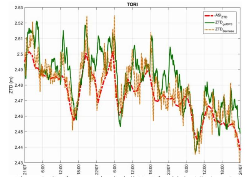
GNSS data of SPIN network and the meteorological ones from the two regional ARPA networks were used to obtain zenith
tropospheric delays and from these the precipitable water vapor (PWV). Validated with independent radiosonde data, the PWV
temporal series were compared with radar precipitation maps of Centro Meteo Lombardo, to identify the presence of characteristic
trends in correspondence of the considered rain events. Results show that a regional network of GNSS receiver can detect spatially
wide extreme rain events; they show also that the inter-distances of such receivers (40-50 km) are too long with respect to very localized
phenomena, whose spatial extent is limited to some km.
The use of low-cost receivers, which would make the densification of geodetic networks economically feasible, was finally evaluated.
Although the results obtained in this paper are quite preliminary, they confirm the potentiality of these receivers, despite their use
requires more effort in data processing, mainly due to the availability of only one frequency.
Downloads

Downloads
Published
How to Cite
Issue
Section
License

This work is licensed under a Creative Commons Attribution-ShareAlike 4.0 International License.


