An open source platform for indoor navigation: application to the faculty of civil and industrial engineering of "Sapienza” University of Rome
Keywords:
Indoor navigation, geomatics, OpenStreetMap, OpenLevelUpAbstract
"Granting structure and identity to the environment is a vital capacity of all animals with movement." (Lynch, 1964)
It is precisely from this that the idea of the project proposed here is inspired, by the attempt to propose the territory that people dwell
on a sheet, giving specific order to the elements; as it is the absence of loss and the ability to orient ourselves to give us a sense of
balance and well-being. "The same word lost means in our language much more than simple geographical uncertainty: it brings with
it shades of true tragedy. [...] One might object, that the human brain is wonderfully adaptable. [...] Still, even the sea has the sun and
the stars, the winds, the currents, the birds and the color of the water without which the navigation would be Impossible." (Lynch,
1964) Cartography plays a fundamental role for all geographic data, that are data which have a spatial attribute as the main feature;
The phenomena that can be described starting from their positioning are termed georeferenced. Cartography, therefore, deals with the
storage (and representation) of georeferencing data; it aims to provide a knowledge of both local and general territory, to develop
logic processes based on relationships and to serve as a base for planning, planning and management of the territory (Brovelli, 2000).
It is in this context that the project is inserted in an attempt to provide a useful and powerful tool that allows a single user to navigate,
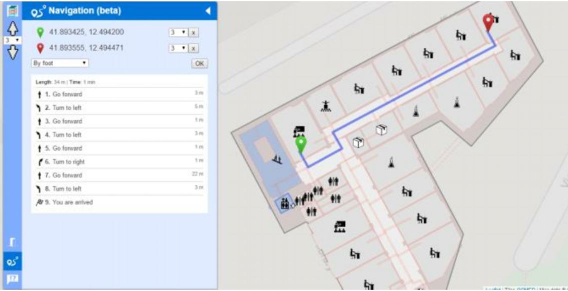
in real time, in areas without GNSS coverage. The project proposes the use of an Open Source platform to support indoor navigation
and shows an application in the environments of the Faculty of Civil and Industrial Engineering at the University of Rome
"Sapienza".
Downloads

Downloads
Published
How to Cite
Issue
Section
License

This work is licensed under a Creative Commons Attribution-ShareAlike 4.0 International License.


