Examples of dendrochronology and geomatics integration to study natural hazards and landscape changes
Keywords:
GIS, Dendrochronology, Avalanches, Debris Flow, riverbed change, forestsAbstract
The Italian territory is subject to high avalanche and hydrogeological risks and the monitoring of natural hazards is of extreme
importance in this context. The historical records of past events are sometimes available but data are often incomplete. Past history
showed that the monitoring and mapping of these phenomena can contribute to avoid or reduce damage in the future. We present the
results of different studies carried out at the Ecology Lab of the University of Trento. In particular, an integrated approach has been
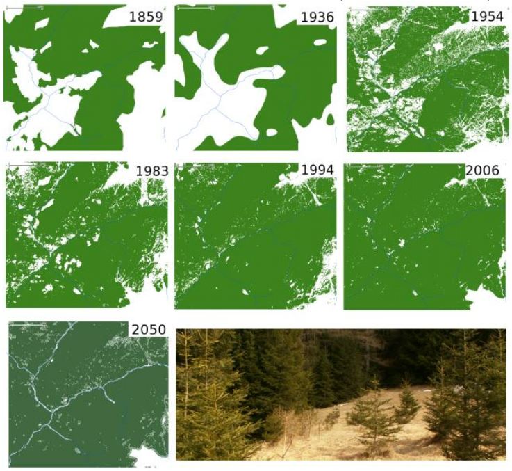
used by combining geomatics and dendrochronology techniques. Case studies concerning avalanches, debris flows, natural
reforestation (Trentino) and riverbed path changes (Albania) are presented. The cartographic information was provided by official
sources of public organizations or processed from remote sensed imagery. Using GRASS and QGIS, it was possible to create multi-
temporal maps showing the effects of the phenomena on forest landscape, to produce morphological and potential risk maps and to
spatialize information coming from dendrochronological analysis. The integration of geomatics and dendrochronological techniques
can effectively contribute to the study of avalanches, debris flow, riverbed change and landscape change, allowing the spatial and
temporal modelling including the reconstruction of paths and volumes of occurred phenomena. In order to prevent new phenomena
in a changing climate, these reconstructions are extremely important for the areas that are more exposed to the direct risks of
avalanches and debris flows.
Downloads
Downloads
Published
How to Cite
Issue
Section
License

This work is licensed under a Creative Commons Attribution-ShareAlike 4.0 International License.

