Issues and solutions on quick survey and fast photogrammetric restitution of CH in complex natural environments. The example of the Manfredonic Castle of Mussomeli
Keywords:
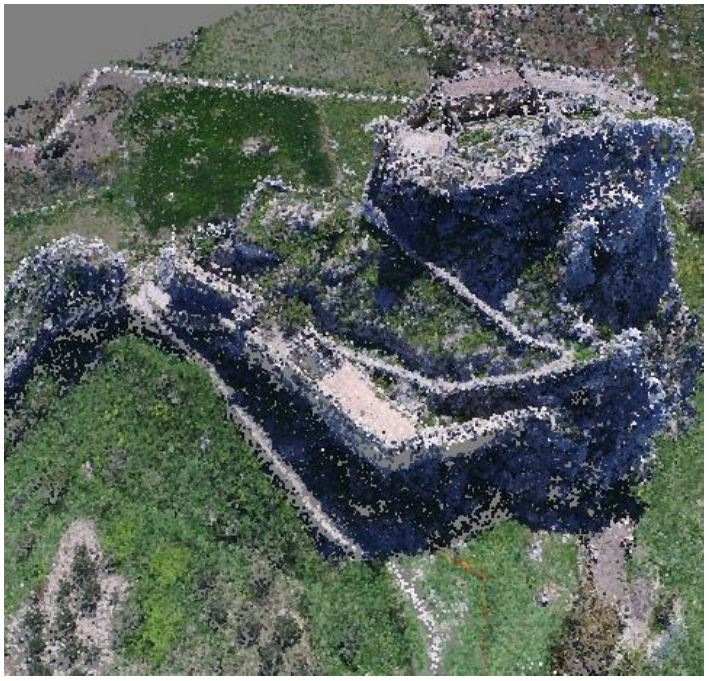
Survey, photogrammetric restitution, UAV technologies, 3D CH modelsAbstract
The most recent innovation on digital photogrammetry has led to substantial changes compared to traditional survey methodologies.
These technologies, alongside the development of increasingly accurate GNSS satellite positioning systems, have been able to
achieve higher levels of precision, at a reduced cost, specially working in perfect conditions. Indeed, real working conditions during
survey operations led often troubles, due to weather, morphology of the terrain, time, resources available and the complexity of the
object to survey; all these factors contributed to the reduction of the quality of expected results. Therefore, it's considered object of
interest to illustrate the survey of a very large monumental complex and the next 3D restitution, developed for the valorization of the
good, timeless activities carried out with few human resources and complex working conditions. The object of the survey has been
the Manfredonic Castle of Mussomeli, a large medieval structure built on a massive large rock that rises overhanging the
surrounding hills. The survey of the castle, unconquered over the centuries thanks to the position, has been characterized by
executive difficulties caused by the presence of inaccessible environments and, generally, the morphological complexity of the
surrounding area, high difference in elevation between the parts, general atmospheric and microclimatic conditions in the restricted
area - as the presence of strong currents of air and vortices near the walls of the rock - , all aspects that have affected the final result.
The level of precision obtained was sufficient to guarantee the geometric reconstruction of a 3D model, allowing to improve the
knowledge of the good under the geometric aspect for the further development of activities for the virtual valorization. The work has
been developed within the PON NEPTIS European Project, aimed at enhancing the CH (Cultural Heritage) through the use and
experimentation of new information technologies.
Downloads
Downloads
Published
How to Cite
Issue
Section
License

This work is licensed under a Creative Commons Attribution-ShareAlike 4.0 International License.

