GIS tools and triggering for active monitoring of forest fire
Keywords:
open-source GIS, monitoring, forest fireAbstract
In recent years, climate factors and seasonal trends led to a drastic increase of forest fires. The most affected regions are concentrated
in the Mediterranean. In particular, in Italy in 2015, there were about 5447 forest fires, for a total of burned area of 37,582 ha (State
Forestry, 2016). Comparing these data with those of previous years it is very clear that the management of these fires, and in
particular the monitoring of risk areas, is a matter that should not be underestimated in order to preserve the natural heritage and
safeguard human lives. That being the case, the general trend, in Italy, at the regional level is the development of GIS tools able to
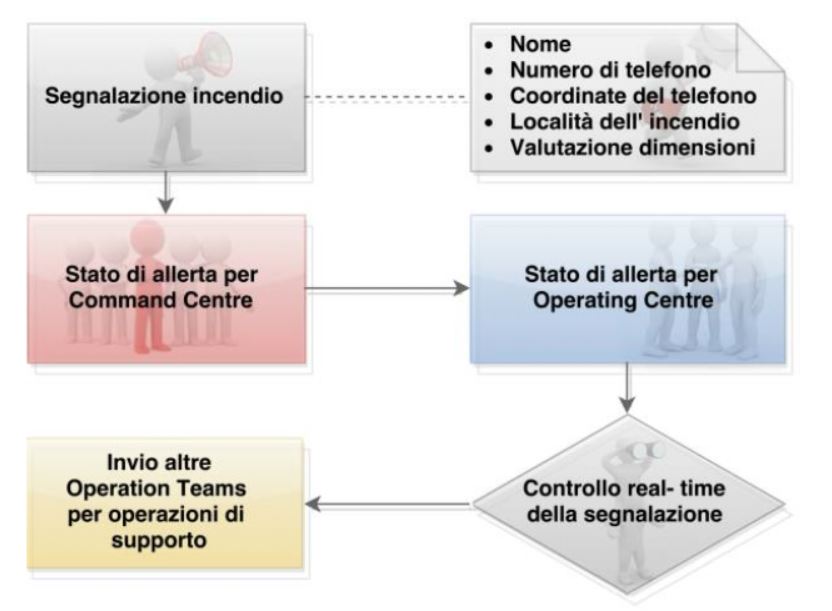
make more effective planning and monitoring as well as improving the coordination aspects in emergency situations. This paper aims
to describe the methodology of development of a GIS tool, which wants to promote the synergy among various forces involved in the
overall management of forest fires. The methodological approach highlights the potential of using open-source platforms and the
possibilities of using GIS tools not only as a simple database, but also as decision assistent tools. In this regard, we intend to show
the implementation strategy that allows this tool to stand as a useful real-time application for active monitoring.
Downloads
Downloads
Published
How to Cite
Issue
Section
License

This work is licensed under a Creative Commons Attribution-ShareAlike 4.0 International License.

