Comparison between traditional measurements and satellite technique on an earth dam and on a concrete dam
Keywords:
Dams monitoring, SAR, COSMO-SkyMed, vertical displacements, levellingAbstract
The improvement of the methods for dam deformation monitoring represents a growing issue among the community that deals with
the safety of critical infrastructures. Although dam failures are usually sudden, in the majority of cases it is possible to understand in
advance when structural damage conditions might evolve in a dangerous process. Nowadays, the development of innovative
methodologies for the static and dynamic structural modeling allows to sharply improve the capability of predicting collapses, thus
preventing and reducing the associated risks. With respect to this issue, several geomatic techniques can be profitably exploited for
the implementation of analytical and mathematical models. This is accomplished by benefiting from the availability of dense and
accurate displacement measurements provided both by satellite data and ground sensors having high temporal and spatial coverages.
As for satellite-based technologies, the improved capability relies on the detection of accurate ground displacements on the whole
infrastructure with no need to install locally control points. The availability of spatially dense deformation measurements is of crucial
importance for structural modeling because it allows us to overcome the drawbacks of traditional monitoring systems, which provide
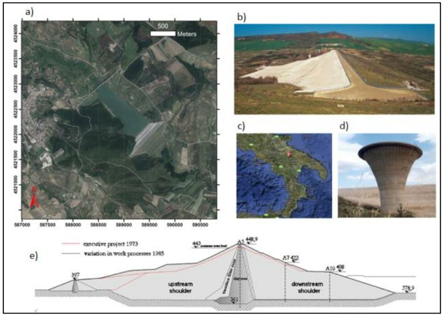
high accuracy measurements only on a limited number of points. The aim of this work is to show the results on two case studies: the
Genzano di Lucania earth dam (PZ) and at Corbara gravity dam (TR) relevant to the monitoring of the dams. In particular, we show
how satellite measurements can be profitably exploited and effectively integrated with the traditional measurements, in order to
improve the current monitoring systems and increase the safety of dams.
Downloads

Downloads
Published
How to Cite
Issue
Section
License

This work is licensed under a Creative Commons Attribution-ShareAlike 4.0 International License.


