3D GIS for the management of architectural elements in historical cities: the porch of the St Francisco Church and the medieval area "Lavagine" in Urbino, Italy
Keywords:
3D GIS, modelling, survey, cultural heritageAbstract
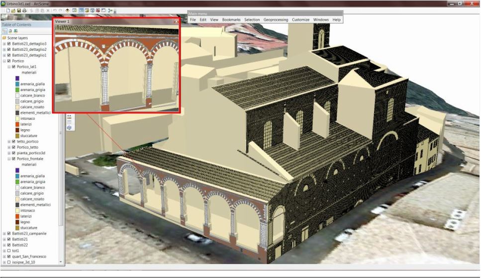
The project aims at representing the historical center of Urbino, defining its morphology and historical transformation, using GIS
and 3D and especially analyzing the state of conservation and possible restoration of some monuments, such as the Portico of the
Church of San Francesco in the medieval quarter of Lavagine. By integrating different surveying methods - topographic,
photogrammetric and laser scanner – a three-dimensional representation of the building has been achieved through rectifications,
orthophotos, plano-altimetric maps and detailed drawings. GIS is used in an innovative manner to provide three-dimensional data
management. All alphanumeric and geometric data are associated with proper positioning and geo-referencing of plans and
elevations and together they integrate, in 3D Geodatabase, the polygonal shaped elements of the buildings and all the thematic maps
that describe the shape and characteristics of the territory in which they are inserted, to achieve quick availability and query, in
addition to quantitative analyses and statistics and other different types of processing.
Downloads
Downloads
Published
How to Cite
Issue
Section
License

This work is licensed under a Creative Commons Attribution-ShareAlike 4.0 International License.

