Definition and implementation of a model for the evaluation of intervention times for emergencies on railway lines
Keywords:
space-time model, emergencies, rail network, rescueAbstract
Emergencies on railway lines present critical aspects due to the intrinsic characteristics of a railway line in itself and to its peculiar
use. A model for the evaluation of the minimal time required, for technical and medical personnel, to reach the emergency place
starting from fire stations and hospitals is defined and implemented in the GRASS GIS. Starting from the known positions of fire
stations and hospitals, the minimum time required to travel the shortest path to the point of the road network closer to the point of the
emergency place on the railway line is computed. A second time is computed considering the shortest path connecting the previously
found point on the road network to the emergency point on the railway line. This second time is evaluated keeping into account the
characteristics of the rescue squad supposed to operate on the emergency spot, and the characteristics of the ground morphology and
coverage. The sum of these two times is then compared to the sum of a) the time required to travel from fire stations and hospitals to
the point on the road network from which it is possible to access the railway line and b) thetime required to walk along the railway
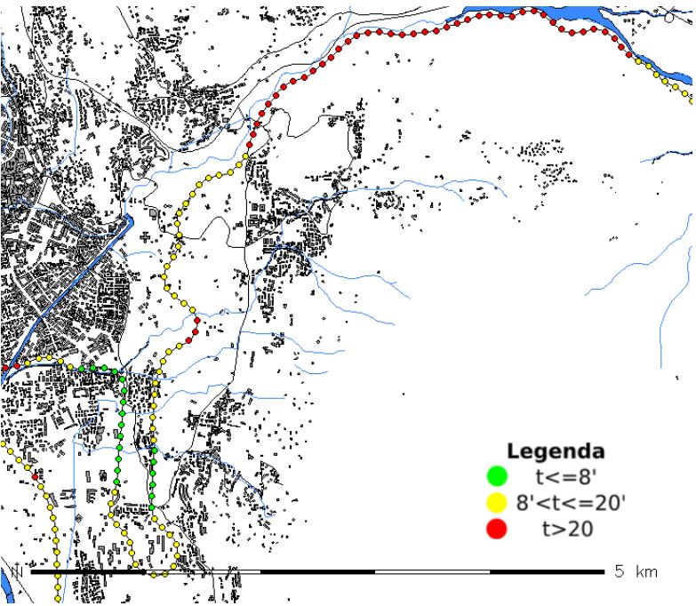
line from the access point to the emergency spot. The railway line is described by a set of evenly spaced points, at a mutual distance
of 100m; the evaluation of the minimum access time is carried out for each point automatically using a scripted procedure in
GRASS GIS. The times described above are combined to compute an index expressing in a compact way the accessibility level of
each point of the railway line. The accessibility index and the minimum access times are represented on maps which can support
crisis management and at the same time provide useful information for the analysis of the safety state of a railway line, helping in
the planning of its improvements.
Downloads
Downloads
Published
How to Cite
Issue
Section
License

This work is licensed under a Creative Commons Attribution-ShareAlike 4.0 International License.

