An application in GRASS to identify suitable areas for the installation of an offshore fish farming facilities
Keywords:
GRASS, marine coastal management, fish farming, spatial planning, suitable site selectionAbstract
The coastal zone management is a complex process that aims at integrating the exploitation of the area with the conservation of a
good environmental quality. Since this is a complex spatial problem, it can be addressed through the GIS systems. Here we presents
an approach applied to offshore fish farming, implementing a procedure in GRASS for identifying suitable areas for the installation
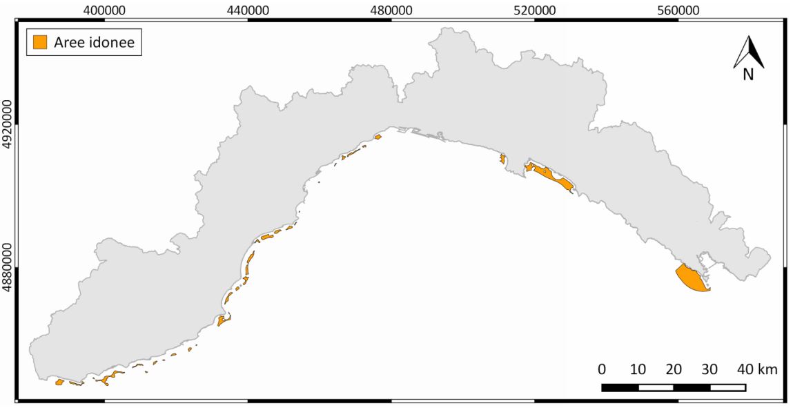
of new facilities for such activity. The study area is the Liguria Region (Italy). The site selection is based on the definition of two
main criteria that determine the suitability for such activity (“not suitable areas” and “potentially suitable areas”) and of conditions
concerning the study area. The procedure outputs the final map with suitable areas, combining the criteria maps previously created.
About 30 suitable areas were identified along the Ligurian coast, mainly located in the west, but the ones with the largest extension
are at east. The procedure was verified comparing the areas identified with the position of the existing farms, all falling in these. The
results of this work show that this procedure is a valuable system for the identification of suitable areas in a simple, fast and efficient
way. This procedure, if appropriately modified, can be applied to any marine coastal system and can be adapted to other activities of
the coastal zone. This work is thus a solid basis for a future development of a Spatial Decision Support System, that provides
multiple scenarios for the stakeholders in order to facilitate the decision making process.
Downloads
Downloads
Published
How to Cite
Issue
Section
License

This work is licensed under a Creative Commons Attribution-ShareAlike 4.0 International License.

