Geomatics integration techniques for the interpretation of multi-temporal changes in geometries and volumes of quarries
Keywords:
geomatics integration techniques, multi-temporal interpretation, geometries of quarries, GNSS surveysAbstract
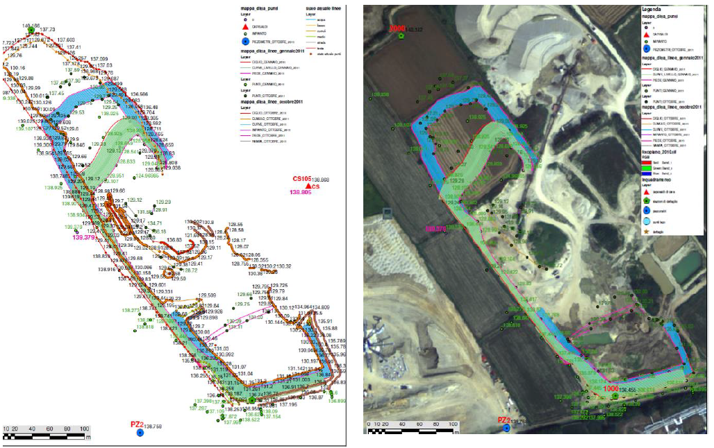
Geomatics offers numerous techniques that can provide territorial information, properly time-localized for understanding of multi-temporal dynamic phenomena. In particular, mining activities (cultivation of quarries and mines) require inspection and verification necessary for the protection and preservation of the environment and the territory already widely applied, sometimes incorrectly, and often without taking advantage of the wealth of data available. In the present work will be shown how the integration of different Geomatics techniques could be of support to the decisions of a legal nature when, for example, it is necessary to evaluate the geometries and volumes of quarries.
Downloads
Downloads
Published
How to Cite
Issue
Section
License

This work is licensed under a Creative Commons Attribution-ShareAlike 4.0 International License.

