Opensource Solutions for Sharing Integrated 3D Geospatial Layers on the Web
Keywords:
WebGIS, Database, WebGL, 3D modelling, IoT, digital twinsAbstract
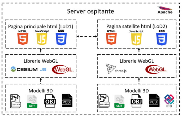
The ever-increasing use of complex geospatial datasets is now a constant in many application fields. For the purposes of optimal exploitation of these data, their integration in a geospatial environment is necessary for the analysis and processing of the datasets. This is how urban Digital Twins are born, i.e. urban-scale digital twins real-time connected to the real model, and viewable through the WebGIS platform. Likewise, the complexity, size and heterogeneity of this data makes its management, and its web sharing online complex. In light of this, this contribution analyzes the structuring of an integrated system for the visualization, analysis and network processing of complex 3D datasets, through the exclusive implementation of open-source technology. This type of system is capable of uploading georeferenced maps, 3D models, point clouds, data from sensors, databases, and real-time calculation systems. The exclusive choice of open-source solutions aims to favor sustainable solutions for the purposes of research and free sharing of the developed technologies. Compared to proprietary solutions, open-source solutions require scripting skills in HTML, JavaScript, Python, PHP and CSS languages. In the future, new implementations of Machine Learning within these platforms will give the possibility of integrating the processing coming from artificial intelligence in real time, further enhancing the possibilities of use.
Downloads

Downloads
Published
How to Cite
Issue
Section
License
Copyright (c) 2024 Marcello La Guardia (Autore)

This work is licensed under a Creative Commons Attribution-ShareAlike 4.0 International License.


